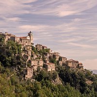


Tanga Tanzania
Tanga, a major industrial centre until the collapse of the sisal market, is Tanzania’s second-largest seaport and its fourth-largest town behind Dar es Salaam, Mwanza and Arusha. Despite its size, it’s a pleasant place with a sleepy, semi colonial atmosphere; wide streets filled with cyclists and motorcycles, intriguing architecture and faded charm. It makes an amenable stop en route to or from Mombasa, and is a springboard to the beaches around Pangani.
The town centre is along the waterfront and easily covered on foot. About 1.5km south of here south of the railway tracks in the Ngamiani section, is the bus station. About 2km east of town, reached by following Hospital Rd (which runs parallel to the water) is the quiet, residential Ras Kazone section, with several hotels and eateries.
History
Although there has probably been a reasonably sized settlement at Tanga since at least the Shirazi era, the town first came into its own in the early to mid-19th century as a starting point for trade caravans to the interior. Ivory was the main commodity traded, with a turnover of about 70,000lb annually in the late 1850s, according to explorer Richard Burton who visited here. The real boom, however, came with the arrival of the Germans in the late 19th century. They built up the town and harbor as part of the construction of a railway line linking Moshi and the Kilimanjaro region with the sea. The Germans also introduced sisal to the area, and Tanzania soon became the world’s leading producer and exporter of the crop, with sisal the centre of local economic life. In WWI, Tanga was the site of the Battle of Tanga (later memorialized in William Boyd’s novel, An Ice-Cream War), in which poorly prepared British troops were soundly trounced by the Germans.As the world sisal market began to collapse in the 1970s, Tanga’s economy spiraled downward. Today, much of the town’s infrastructure has been abandoned and the economy is just a shadow of its former self, although vast plantations still stretch westwards along the plains edging the Usambara Mountains.
Sights & Activities
The most interesting areas for a stroll are around Jamhuri Park overlooking the harbor. Here you’ll find the old German-built clock tower, and the park and cemetery surrounding the Askari Monument at the end of Market St.Urithi Tanga Museum
Tanga’s old boma has been rehabilitated, and now houses this small but worthwhile museum, with historical photos and artifacts from the area.Toten Island
Directly offshore from Tanga is this small, mangrove-ringed island (‘Island of the Dead’) with the overgrown ruins of a mosque dating at least to the 17th century and some 18th- and 19th-century gravestones. Pottery fragments from the 15th century have also been found, indicating that the island may have been settled during the Shirazi era. Toten Island’s apparently long history ended in the late 19th century, when its inhabitants moved to the mainland. While the ruins are less accessible and less atmospheric than those at nearby Tongoni, the island is worth a look if you have extra time for about US$65 per person including motor boat transfer and guided tour.Tanga Yacht Club
This place has a small, clean beach, showers and a restaurant-bar area overlooking the water. It’s a pleasant place to relax and, especially on weekend afternoons, it’s a good spot to meet resident expats and get the lowdown on what’s happening in town.Galanos Sulphur Springs
If bending and crawling around the caves has left you feeling stiff in the joints, consider finishing the day with a visit to these green, odorous and rather underwhelming sulphur springs nearby. (They are included with most Amboni Cave tours.) The springs take their name from a Greek sisal planter who was the first to recognize their potential for relaxation after the rigors of a long day in the fields. Now, although still in use, they are quite unappealing despite their purportedly therapeutic properties. The spring is along the Tanga–Mombasa road, about 2km north of the turn-off for the caves, just after crossing the Sigi River. From here, it’s about 2km. Dalla-dallas from Tanga run as far as Amboni village, from where you’ll need to continue on foot.Amboni Caves
Long the subject of local legend, these limestone caves are one of the most extensive subterranean systems in East Africa and an intriguing excursion for anyone with an interest in spelunking. Now home to thousands of bats, they were traditionally believed to house various spirits, and continue to be a place of worship and ritual.The caves were originally thought to extend 200km or more, and are said to have been used by the Kenyan Mau Mau during the 1950s as a hideout from the British. Although a 1994 survey concluded that their extent was much smaller – with the largest of the caves studied only 900m long –rumors of them reaching all the way to Mombasa persist. It’s possible to visit a small portion of the cave network, which is quite interesting, once you get past the litter at the entrance. Bring along a torch and wear closed shoes to avoid picking bat droppings off your feet afterwards. The caves are about 8km northwest of Tanga off the Tanga–Mombasa road.
Usambara Mountains
With their wide vistas, cool climate, winding paths and picturesque villages, the Usambaras are one of northeastern Tanzania’s delights. Rural life revolves around a cycle of bustling, colorful market days that rotate from one village to the next, and is largely untouched by the booming safari scene and influx of 4WDs in nearby Arusha. It’s easily possible to spend at least a week trekking from village to village or exploring with day walks.The Usambaras, which are part of the ancient Eastern Arc chain, are divided into two ranges separated by a 4km-wide valley. The western Usambaras, around Lushoto, are the most accessible. The better road net-work here means they get a lot of tourists.
The eastern Usambaras, around Amani, are less developed. Both ranges are densely populated, with an average of more than 300 people per sq km. The main tribes are the Sambaa, Kilindi, Zigua and Mbugu.
Although the climate is comfortable year round, paths get too muddy for trekking during the rainy season. The best time to visit is from June to November, after the rains and when the air is clearest.
Amani Nature Reserve
The often overlooked Amani Nature Reserve is located west of Tanga in the heart of the eastern Usambaras. It’s a peaceful, lushly vegetated patch of montane forest humming with the sounds of rushing water, chirping insects and singing birds. It is also exceptionally rich in unique plant and bird species – a highly worthwhile detour for those ornithological or botanically inclined.Among the unique bird species you may see are Amani sunbirds, banded green sunbirds and the green-headed oriole.
History
Although Amani was only gazetted as a nature reserve in 1997, research in the area began a century earlier when the Germans established a research station and botanical gardens here. Large areas of forest were cleared and numerous new species introduced. Within a few years the gardens were the largest in Africa, totaling 304 hectares and containing between 600 and 1000 different species of plants, including many endemic species. Soon thereafter, exploitation of the surrounding forest began and the gardens began to decline. A sawmill was started and a railway link was built connecting Zigi, about 12km below Amani, with the main Tanga–Moshi line to transport timber to the coast.During the British era, research shifted to Nairobi, and the railway was replaced by a road linking Amani with Muheza. Many of the facilities at Amani were taken over by the nearby government-run malaria research centre and the gardens fell into neglect. More recently, thanks to funding from the Tanzanian and Finnish governments and the EU, projects have been underway to promote sustainable resource use by local communities. Local guides have been trained and visitor access to the eastern Usambaras has improved thanks to a trail network.
Sights & Activities
There’s a visitor centre at the old Station Master’s House at Zigi with information about the area’s history, animals and medicinal plants.Walking Trails
For getting around, there’s a network of short walks along shaded forest paths that can be done alone or with a guide. Most trails take between one and three hours. They are detailed in the booklet A Guide to Trails and Drive Routes in Amani Nature Reserve, on sale at the information centre at Zigi and at the reserve office in Amani.Lushoto
This leafy highland town is nestled in a fertile valley at about 1200m, surrounded by pines and eucalyptus mixed with banana plants and other tropical foliage. It’s the centre of the western Usambaras and makes an ideal base for hikes into the surrounding hills. Lushoto is also the heartland of the Wasambaa people (the name ‘Usambara’ is a corruption of Wasambaa or Washambala, meaning ‘scattered’). Local culture is strong.In Muheza and parts of the Tanga region closer to the coast, Swahili is used almost exclusively. Here however, Sambaa is the language of choice for most residents.
History
During the German era Lushoto (then known as Wilhelmstal) was a favored holiday spot for colonial administrators, a local administrative centre and a mission station.It was even slated at one point to become the colonial capital. Today, thanks to a temperate climate, it’s best known for its bustling market – liveliest on Sundays – and its superb walking opportunities. In addition to a handful of colonial-era buildings – notably the German-built churches, the prison and various old country estates – and the paved road from Mombo, the Germans left a legacy of homemade bread and cheeses, now produced by several missions in the area. Due in part to the high population density of the surrounding area and the resulting deforestation, erosion has long been a serious concern for this region. Erosion-control efforts were first initiated during the British era and today various projects are underway.


 Verified