Ngorongoro Highlands
The hauntingly beautiful Crater Highlands is where the Rift Valley really gets interesting. The highlands warp along numerous extinct volcanoes, calderas (collapsed volcanoes) and the dramatic Rift Valley Escarpment on the park’s eastern side. The peaks include Oldeani (3216m), Makarot (Lemagurut; 3107m), Olmoti (3100m), Loolmalasin (3648m), Empakaai (also spelled Embagai; 3262m), Ngorongoro (2400m) and the still-active Ol Doinyo Lengai (2878m). The different peaks were created over millions of years by a series of eruptions connected with the birth of the Great Rift Valley, and the older volcanoes have since collapsed, forming the striking ‘craters’ (really, they’re calderas) that give the range its name.
Sights
Olmoti Crater
Although it lacks the drama of Ngorongoro and Empakaai, Olmoti Crater, 13km north of the Lemala ascent-descent road, is worth visiting on your way north into the Highlands.It’s also the starting point for a two-day trek to Empakaai Crater. Olmoti’s crater floor is shallow, haired with grass and crossed by the Munge River. To reach the rim, it’s a one-hour return walk from where the 4WD track ends on the crater’s eastern side. From here, a short trail leads to the Munge Waterfall.
Empakaai Crater
Lake-filled Empakaai Crater, 23km northeast of Olmoti Crater, may not be as famous as Ngorongoro, but many travelers consider it to be its match in beauty. The lake, which draws flamingos and other water birds, fills most of the crater floor, which is surrounded by steep-sided, forested cliffs at least 300m high. The view from the crater rim is one of our favorites in northern Tanzania, but hiking down into the crater is a wonderful experience as well.The road from Ol Doinyo Lengai runs along part of the eastern crater rim, which varies in altitude from 2700m to 3200m, and a steep, well-kept trail descends from the road through montane forest rich in bird life. Also keep an eye out for hyenas, buffaloes, blue monkeys and even elephants
En route to the crater floor, watch for views of the turquoise lake down below and the perfect volcanic cone of Ol Doinyo Lengai away to the northeast. Count on around 30 minutes the lake shore and about 1 hour to climb up back. It is possible to circumnavigate the lake on foot, which will take at least four hours. If you’re planning on hiking, you are, in theory, required to pick up an armed ranger at Nainokanoka ranger post (next to Olmoti Crater) en route to Empakaai. To get here, count on a 90-minute drive from the Lemala ascent-descent road.
Engaruka ruins
Halfway to Lake Natron, on the eastern edge of the Ngorongoro Conservation Area, lies this 300 to 500 year-old ruin of a farming town that developed a complex irrigation system with terraced stone housing sites. Although the ruins are historically significant, casual visitors are likely to be more impressed with the up-close views of the escarpment than the vaguely house-shaped piles of rocks.Archaeologists are unsure of Engaruka’s origins, although some speculate that the town was built by ancestors of the Iraqw (Mbulu) people, who once populated the area and now live around Lake Eyasi. Others propose it was the Sonjo, a Bantu-speaking people. Knowledgeable English-speaking guides (no set prices) for the ruins or other walks in the area, including a one-day climb of nearby Kerimasi, can be found at Engaruka Ruins Campsite, or arranged in advance . The ruins are unsigned above the village of Engaruka Juu. Turn west at Engaruka Chini, a smaller village along the Lake Natron road, and follow the rough track 4.5km until you reach Engaruka Juu Primary Boarding School.
Ol Doinyo Lengai
Ol Doinyo Lengai (2878m), ‘Mountain of God’ in the Maasai language, is one of the most beautiful mountains in Africa. The northernmost mountain in the Crater Highlands, it’s an almost perfect volcanic cone with steep sides rising to a small flat-topped peak. It’s also the youngest volcano in the Crater Highlands, and still active, with the last eruptions in 2008. Climbing to the summit is one of the most popular Crater Highland treks.At the peak, you can see hot steam vents and growing ash cones in the north crater.
With a midnight start, a trek from the base village of Engaresero at Lake Natron is possible in one long day. Although the number of climbers scaling Ol Doinyo Lengai has grown in recent years, the loose ash along most of the path makes it a difficult climb and an even tougher, often painful, descent. Ol Doinyo Lengai, like most active volcanoes, is a constantly changing landform, and lava flows in 2013 had, at the time of our visit, all but filled the crater created during the 2007–08 eruption. As a result, views down into the crater from the rim or summit were more limited than in previous years. Oldeani is the least complicated option, since the climb starts at headquarters. From Oldeani, it’s possible to camp and continue on down to Lake Eyasi where there’s public transport.
Lake Natron
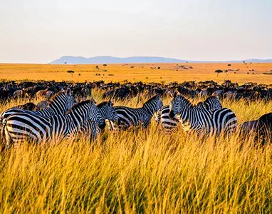
Shimmering amid the sun-scorched Kenyan border northeast of Ngorongoro Conservation Area, this 58km-long, but just 50cm-deep, alkaline lake should be on every adventurer’s itinerary. The drive from Mtowa Mbu is remote, with a desolate, other-worldly beauty and an incomparable feeling of space and ancientness. The road traces the Rift Valley Escarpment through untrammeled Maasai land with small bomas and big mountains always in view on this almost treeless plain. Plenty of zebras, giraffes, wildebeest and ostriches graze in the near distance. From June to November at the lake itself, upwards of three million flamingos gather here – it’s one of East Africa’s most stirring wildlife spectacles.Activities
The base for visits is the small oasis of Engaresero (‘impermanent water’ in Maasai) on the southwestern shore.Oldupai Gorge & Western Ngorongoro
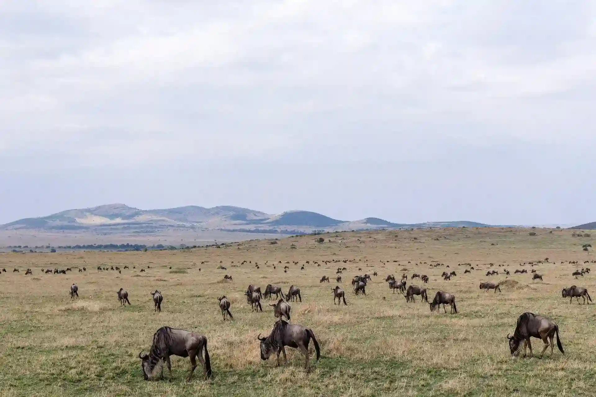
Standing near the western rim of the Ngorongoro Crater and looking out towards the west is like contemplating eternity. Table-flat plains stretch towards the Serengeti with the forbidding Gol Mountains away to the north. Within this landscape, Maasai eke out a subsistence existence from the dust of plains where wildlife is wary but present nonetheless – wildebeest, eland, topi, gazelle and zebra herds come here between January and March on the southern stretch of their endless migration.But there is more to these plains than meets the eye. Slicing its way through up to 90m of rock and two million years of history, Oldupai (Olduvai) Gorge on the plains northwest of Ngorongoro Crater is a dusty, 48km-long ravine sometimes referred to as the cradle of humankind. Thanks to its unique geological history, in which layer upon layer of volcanic deposits were laid down in an orderly sequence up until 15,000 years ago, it provides remarkable documentation of ancient life, allowing us to begin turning the pages of history back to the days of our earliest ancestors.
Sights & Activities
Good easy day-trek spots in the western reaches of the NCA include Makarot, Little Oldupai and Lake NdutuOldupai Museum
The small Oldupai Museum on the rim of Oldupai Gorge stands on one of the most significant archaeological sites on earth. It was here in 1959 that Mary Leakey discovered a 1.8-million-year-old ape-like skull from early hominids (human-like) now known as Australopithecus boisei. This discovery, along with fossils of over 60 early hominids (including Homo habilis and Homo erectus), forever changed the way we understand the dawn of human history.The museum documents the foundation of the gorge, fossil finds and the legacy of Mary Leakey and her husband, Louis. You’re allowed to visit the museum on your own (a series of explanatory panels guide you through the exhibits), then after a guide will give a short lecture. The guide will then take you down into the gorge (where international archaeological teams are still at work) or out to the shifting sands, a 9m-high, 100m-long black dune of volcanic ash that has blown across the plain from Ol Doinyo Lengai.
You’ll need a minimum of 45 minutes to do the museum justice and listen to the lecture, more if you go down into the gorge or visit the shifting sands. The turn-off to the museum is 27km northwest of the Seneto descent road, and from the turn-off it’s a further 5.5km along a rutted track to the museum.


 Verified